Click here to view an interactive map of recent exploration data from the Kinskuch area.
The ~625 square kilometer Kinskuch Project claims surround the Big Bulk porphyry, and are contiguous with the claims covering (i) the Homestake gold/silver deposits, (ii) the Dolly Varden silver mines, and (iii) the Kitsault molybdenum mine.
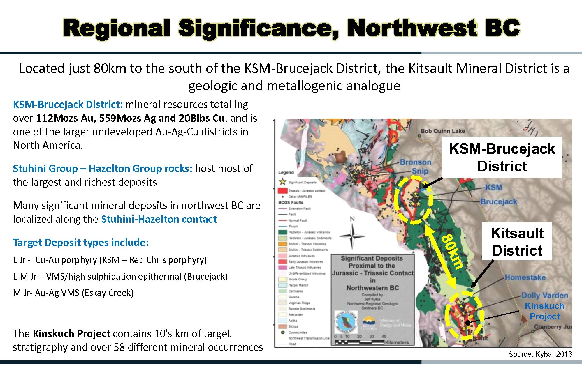
The Kinskuch claims cover many kilometers of the Stuhini/Hazelton contact, thought to control the KSM-Brucejack metallogenic district. Click to enlarge the graphic. A more detailed map of the contact is available on the “Brucejack Comparison” page of this website.
The Kinskuch claims were sold to the Hecla Mining Company in June, 2016.
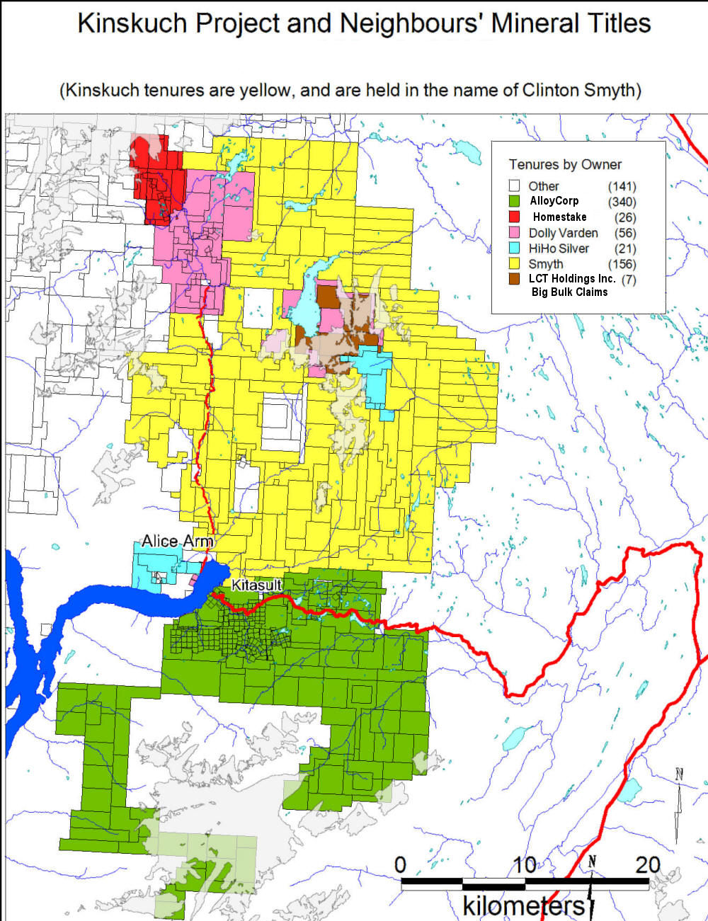
The Kinskuch Claims are in yellow. Click to enlarge
The Kinskuch claims cover a number of exploration targets, one of which, the Illiance River VMS Au, Ag, Zn, Pb target, was successfully drilled by Homestake Resource Corp in 2011.
Targets at Kinskuch have been well-described by Homestake Resources during their period of exploration management in a presentation available here.
2011 drilling results from the Illiance River target are described in detail here, and 2012 follow-up mapping and geological sampling of the target are described in detail here.
Approximately half the licence was subjected to a helicopter-borne magnetic, radiometric and EM survey in 2011, resulting in a rich geophysical database for the property which has yet to be fully exploited. This survey is reported here. Hecla Mining subsequently flew the northern half of the Kinskuch claims, including LCT’s Big Bulk claims, for ZTEM and magnetics in 2017.
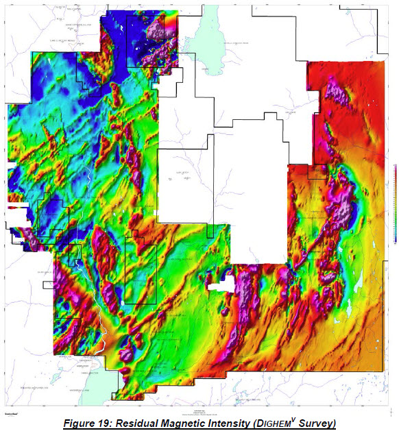
Results of 2011 helimag survey of southern half of the Kinskuch Project claims. Click to enlarge.
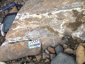
Sample collected from malachite-stained and veined intrusive north of Kinskuch Lake on the Kinskuch property in 2007. These intrusives do not appear on government maps of the area. Click on the above image to view photo albums of fieldwork carried out on the Kinskuch property from 2006 to 2012.